10. 09. 2019
Quantifying impacts on traffic flows using limited data
BY DR BARRY EVANS, UNIVERSITY OF EXETER
There are a number of various critical services being investigated with respect to climate-driven impacts within RESCCUE. These include but are not limited the disruption of electricity supply, waste management, wastewater treatment, building infrastructures, people and transportation. During the study, the lack of data availability and modelling resources has been a key challenge for our analysis. For this reason, within the city of Bristol, the Centre for Water Systems (CWS), University of Exeter, have opted to expand upon the research by one of their former PhD students (Dr Katya Pyatkova) for assessing impacts to the transportation sector (focusing on vehicles) from flooding events. The adopted approach utilises the freely available and open traffic modelling software SUMO (Simulation of Urban Mobility) and road network data obtained via Open Street map.
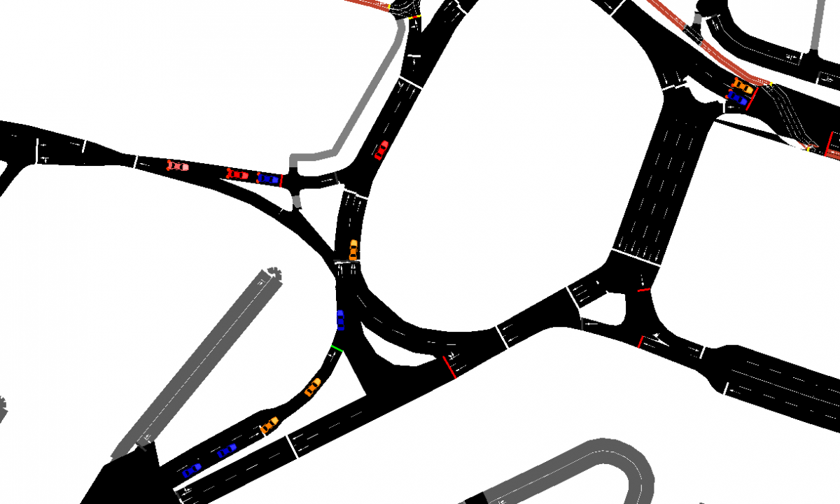
The traffic-modelling tool SUMO allows for the simulation of individual vehicles within the road network that can be defined to move around the road network accordingly based on the characteristics (rules such as speed limits, lane prioritisations and traffic lights) of the roads they are traversing.
To simulate the potential impacts of flooding to traffic flows within the network, the researchers at CWS have been looking at loosely coupling flood model outputs with the dynamic traffic model. With traffic movements within SUMO being governed (in part) by the physical road characteristics, we can alter the characteristics such as permissible speed limits and accessibility with respect to the magnitude of the hazard conditions. Therefore, to simulate impacts of flooding on traffic flows the properties of individual road sections are dynamically adjusted depending on the location, time and magnitude of the hazard on that section present itself.
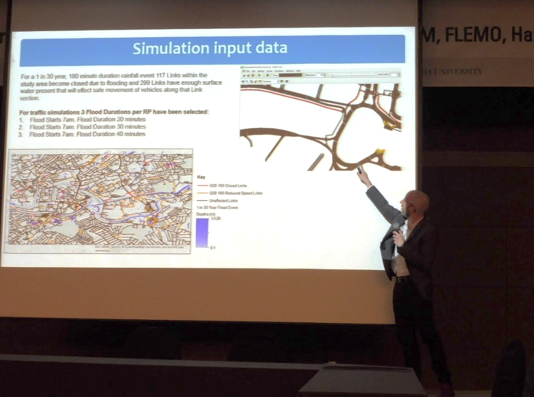
Within a traffic simulation, each vehicle in the network possesses a fixed pair of Origin and Destination points and moves between these points through the road network respectively via the most efficient route in relation to the given traffic conditions. During flood events, due to the reduction of allowable speeds and/or road closures within the road network, the previous route for individual traffic may no longer be optimum and as such, vehicles would have to alter their chosen route. SUMO allows for dynamic re-routing based on analysis of the traffic network and the effects of this rerouting on traffic flows is examined and compared to the normal (dry weather) conditions.
SUMO facilitates a vast number of ways for analysing the effects on traffic mobilisation due to changes to the road network. These effects can be analysed at a multitude of scales ranging from individual aspect up to a full network perspective. As part of preliminary analysis within RESCCUE, we adopted a large-scale approach to examine the impacts, enabling us to quantify the overall performance of the entire network under flooded conditions in relation to normal dry weather conditions and investigate the time taken for the network to recover.
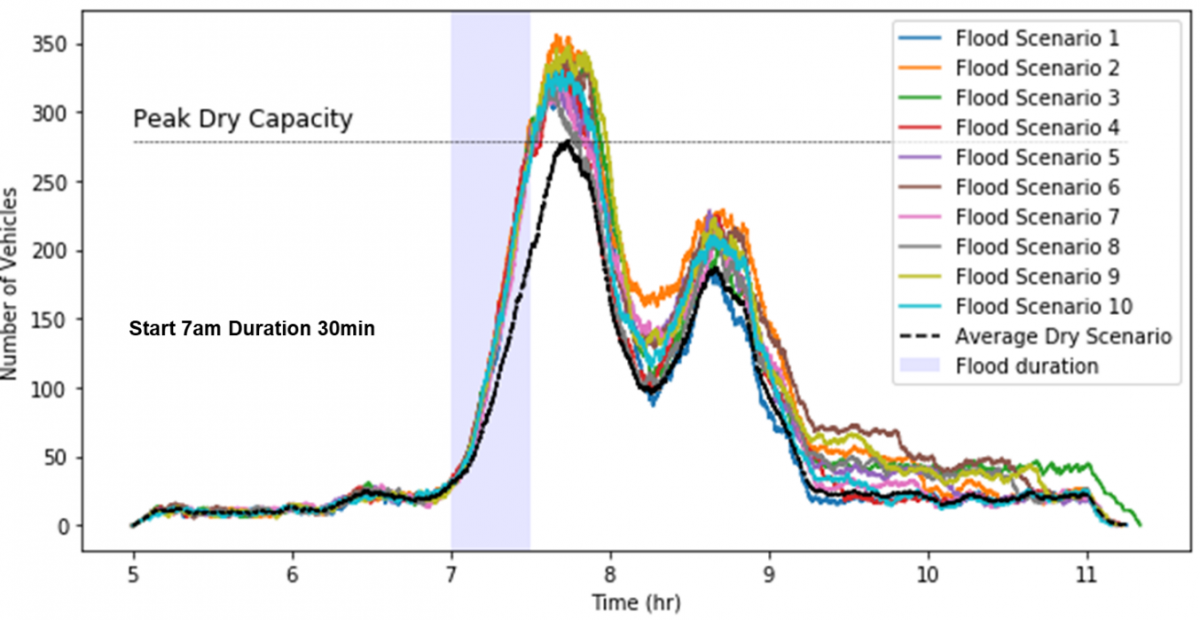

Early results of the analyses carried out within the Bristol research site have highlighted the potential of utilising a loosely coupled modelling approach for hazard impact assessment on traffic mobility. CWS is continuing this work further through the improvement in defining the routing of traffic with the road network via referencing additional data sources such as traffic count information from the local council and examining how traffic flows can be improved for future scenarios through the use of adaptation measures.